
Collective Envisioning of Energy Development Impacts
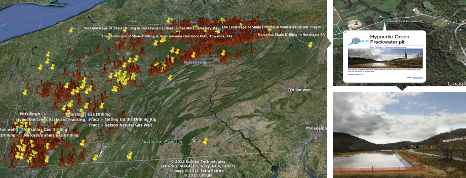
This Public Engagement in Science demonstration project explores the role networked visual evidence plays in contributing to productive public participation and engagement in a complex a socio-technical issue of regional interest – energy development. In particular, we will study how gigapixel-image based cyberinfrastructure can support the integration and co-location of visual evidence in the form of geolocated, high resolution landscape documentation over time, and in combination with LandSat and other public data sources to deepen science-rich dialogue, envisioning, and decision-making processes.
We see the cyberlearning platform being used in multiple ways to promote community engagement and creative solution finding:
· As a dialogue event tool for the presentation of topical panoramic images in public forum and panel discussion settings. It enables online and print versions of visually impressive, gigapixel resolution of images for public viewing, dialogue and facilitation. And it supports recording of pre and post-event discussions within the web-based image to support context-specific dialogue, which persists over time.
· As an online learning environment for the integration of multiple data sources that enables stakeholder and public interactions around visual evidence. Participants can explore drill sites over time revealing the process of development, operation, and mitigation. Through annotation tools, they can link images to community values in the landscape at various scales—revealing personal identity, connections, and local knowledge of the land, its places, and people.
· As an online, time-based image and data visualization platform to integrate geolocated visual documentation, which supports monitoring activities, best practices depiction, and dialogue between developers, municipal/township officials, communities, and other stakeholders.
